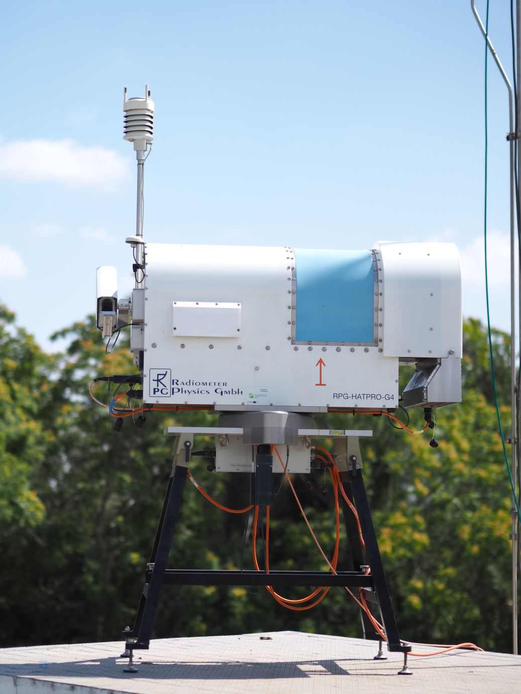
Microwave Radiometer (HATPRO)
The microwave radiometer is of the type Humidity and Temperature PROfiler (HATPRO). This instrument operates continuously since 2014 providing vertical profiles of temperature and humidity, as well as liquid water path and integrated water vapour. The HATPRO is integrated in the Cloudnet data portal that is part of the Aerosol, Clouds and Trace Gases Research Infrastructure (ACTRIS).
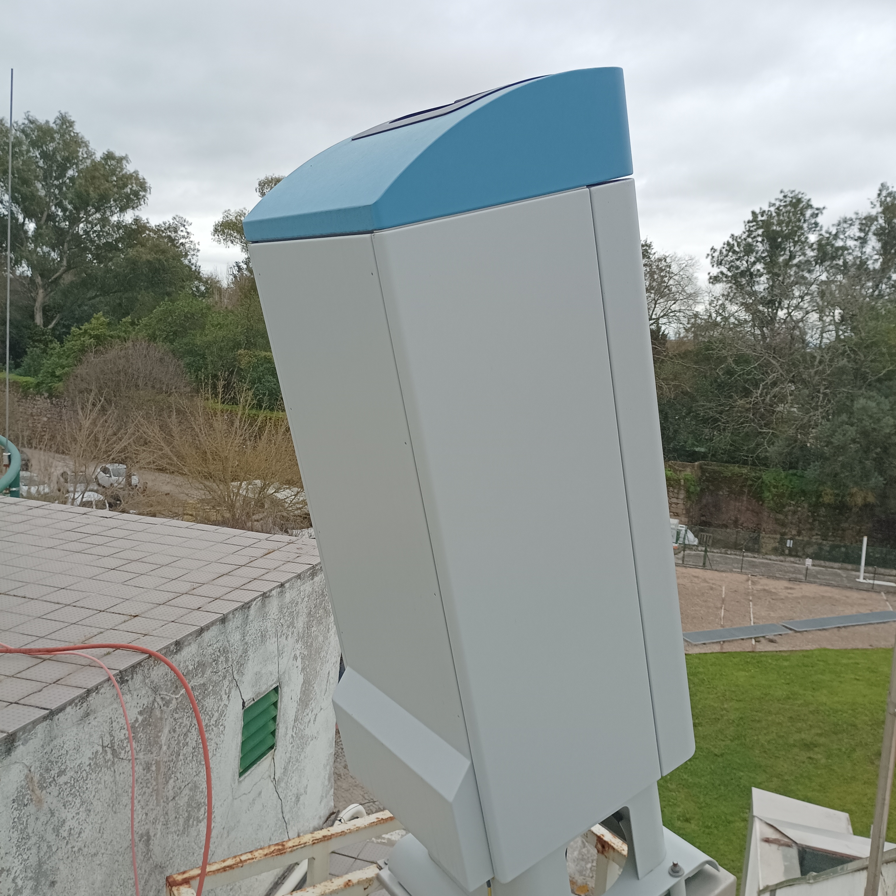
CHM15K Ceilometer
The CHM15k ceilometer is a simple single-shaft backscatter lidar sensor emitting in the near-infrared at 1064 nm. It measures up to 15 km height, allowing the detection of several cloud and aerosol layers. It is continuously measuring since July 2024. CHM15k ceilometer data can be used for several applications such as:
- Analysis of aerosol backscatter profiles
- Aerosol layer height
- Determination of boundary layer height
- Cloud cover and cloud base height detection
- High cirrus clouds observation
- Vertical visibility
The CHM15k is integrated in the EUMETNET E-Profile and ACTRIS Cloudnet networks.
CL31 Ceilometer
The CL31 is a pulsed diode lidar technology and single lens optics emitting in the near-infrared at 940 nm. It measures the cloud base heights detecting up to three cloud layers simultaneously to a range of 7 km. It is operating since 2006 and provides data to EUMETNET E-Profile network since 2023.
PAOLI (PollyXT system)
PAOLI is multi-wavelength Raman lidar system with three elastic channels (at 355, 532 and 1064 nm), two inelastic/Raman channels (at 387 and 607 nm) and one cross-polarization channel (at 532 nm). It is measuring since 2009 providing measurements of particle backscatter and extinction coefficients and particle linear depolarization profiles to altitudes up to 60 km. PAOLI data is used to detect aerosol layers and for aerosol characterization in terms of aerosol types (e.g. desert dust, volcanic aerosols and smoke), concentration and optical properties. This lidar system is part of an international network of cooperation institutes operating Polly systems, called PollyNET. PAOLI is also integrated in the European Aerosol Research Lidar Network (EARLINET) that is part of the ACTRIS research infrastructure.
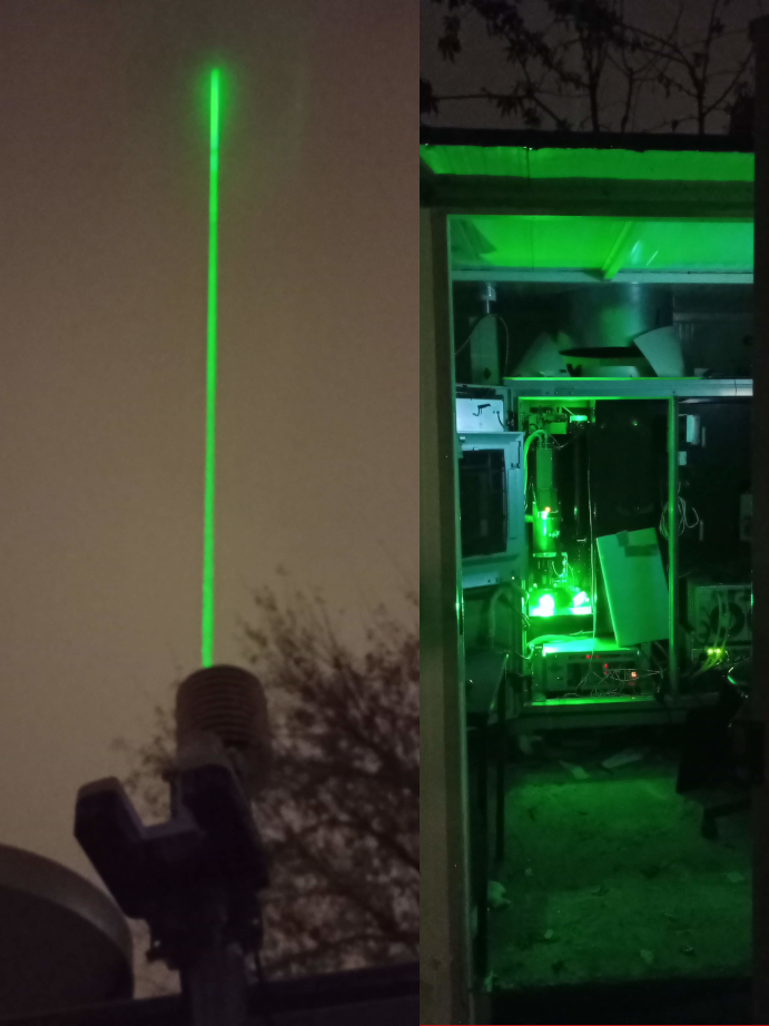
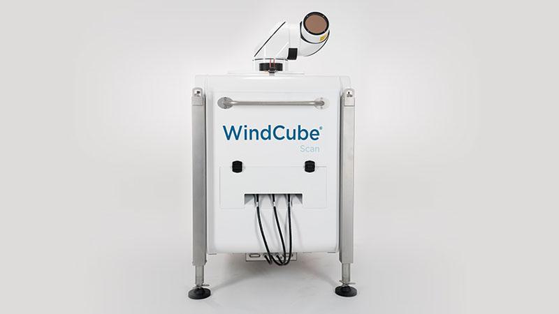
WINDCUBE 100S 3D scanning Doppler Lidar
The Windcube 3D is a scanning Doppler Lidar will provide wind, aerosol backscatter and cloud measurements up to a maximum altitude of 14 km. The Windcube 3D data can be used for several applications such as:
- Boundary layer profiling
- Cloud and aerosol detection
- Weather monitoring
- Analysis of backscatter profiles
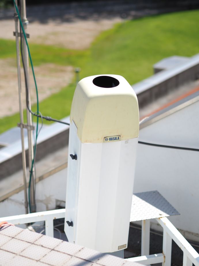
Vaisala CL61 Ceilometer
CL61 ceilometer combines standard ceilometer measurements with depolarization capabilities emitting in the near-infrared at 910.55 nm. It will provide measurements of attenuated backscatter coefficient and depolarization ratio profiles, cloud base heights (up to 5 layers), cloud depth and penetration, precipitation and fog detection up to 15 km height. The depolarization capabilities allow particle and precipitation differentiation. CL61 data can be used for several applications such as:
- Aerosol detection and evolution monitoring (e.g., desert dust, smoke, volcanic aerosols)
- Determination of boundary layer height and characterization
- Cloud detection and characterization

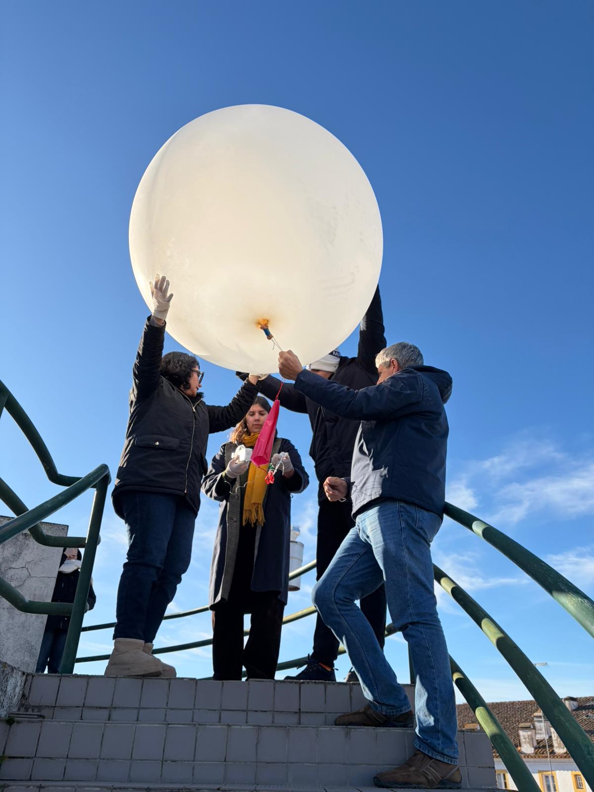
Radiosonde Observations
The probes allow measuring temperature, humidity and wind (direction and intensity) from the surface up to the balloon's burst altitude, which can exceed 25 km. As the balloon ascends into the atmosphere, the signal is transmitted to a station on the surface where a data acquisition system converts the received signal into values of atmospheric variables. A radiosonde launch lasts approximately 2 hours.
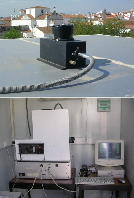
SPATRAM (Spectrometer for atmospheric tracers measurements)
The UV-Visible scanning spectrometric system measure solar scattered radiation at high spectral resolution from 300 to 750 nm in zenith sky and off-axis configuration. The spectral measurements with application of the Differential Optical Absorption Spectroscopy (DOAS) algorithms allow for the retrieval of the slant column densities (SCD) of various atmospheric compounds (NO2, O3, BrO, HCHO…). A Radiative Transfer Model (RTM) calculates the geometrical factor (Air Mass Factor -AMF) used to obtain the Vertical Column Densities (VCD) of the analized gaseous compound. An Optimal Estimation method is applied to retrieve the vertical distribution of NO2 and ozone.